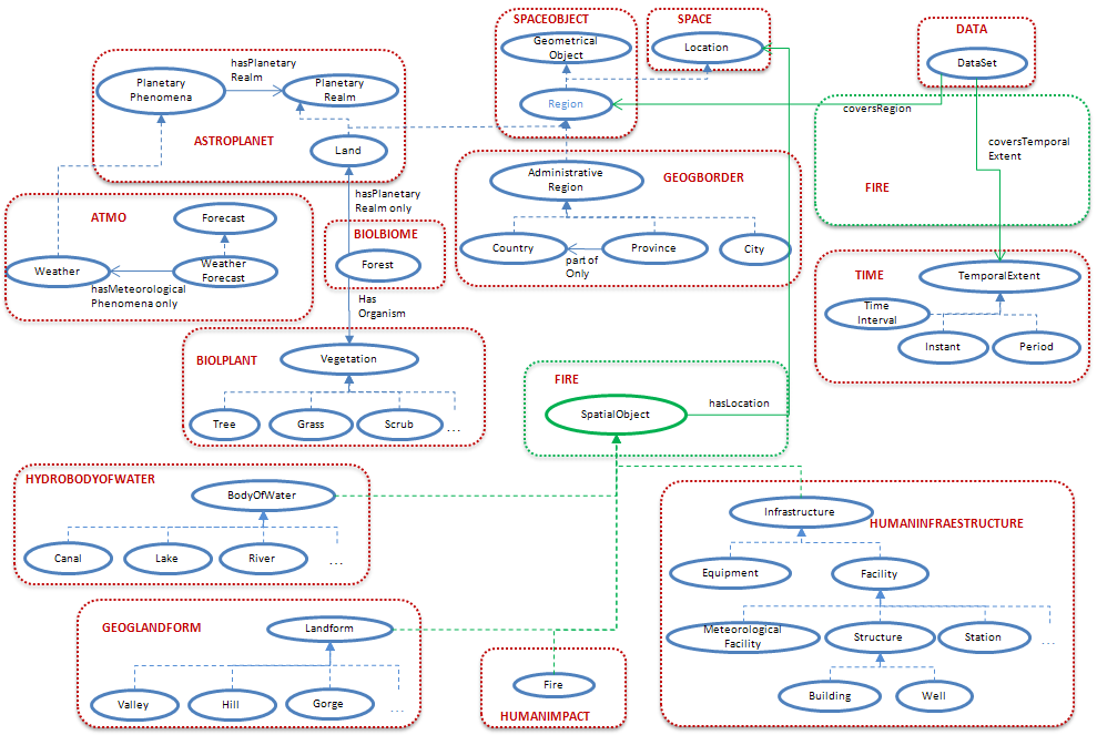
Fire ontology network
The fire ontology network gives support to the project use case on forest fire risk management. After an analysis of the requirements for this application, we have developed these ontologies mainly reusing a good number of ontologies from the SWEET suite, which cover the following domains: fire, forest and vegetation, weather, geography, water body, infrastruscture, location and time; and the core sensor network ontology.
Since SWEET already covers most of the representational needs of this application, we have just added a SpatialObject class to represent objects that have a location, have identified the classes to be considered as spatial objects (bodies of water, landforms, infrastructures, and fire), and have extended the definition of datasets to make them cover a region and a temporal extent.
The figure below presents an overview of the main classes of this ontology network. In the figure, classes are represented as circles, properties as arrows, and rdfs:subClassOf properties as dotted arrows. The different classes are grouped according to the ontology that they belong to and the concepts and properties in green are those that are not present in other ontologies and we had to add.
For further information, please contact Raúl García Castro or This e-mail address is being protected from spambots. You need JavaScript enabled to view it .
 |
SemSorGrid4Env - Semantic Sensor Grids for Rapid Application Development for Environmental Management SemSorGrid4Env is a joint project of seven European partners co-funded by the European Commission's Seventh Framework Programme under DG INFSO H.4 "ICT for Sustainable Growth", starting in September 2008 with a duration of three years. |
 |